

We have rounded up a selection of photographs of old estates and farms in Havering, celebrating our borough's proud past.
From Nelmes Park Estate in Hornchurch and its scenic lake, to surburban developments to Hall Lane in Upminster, the borough has gone through significant change.
We have selected a range of photographs from Havering's past that reflect well-loved estates and farms away from the bustle of the city centre.
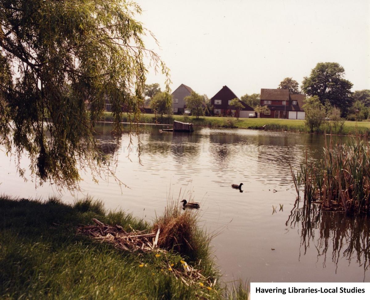
Nelmes Park Estate in Emerson Park, Hornchurch

This photo of Nelmes Park Estate shows a view across the lake and includes, from the right, 2-6 Tyle Green, according to Havering Libraries.
The Luck Brothers firm was given permission to start building the estate in 1979.
It has been described as a pleasant oasis in the middle of housing with open grass, mature trees and a picturesque lake.
MORE NOSTALGIA: Historic Rainham and Hornchurch pubs captured in photos
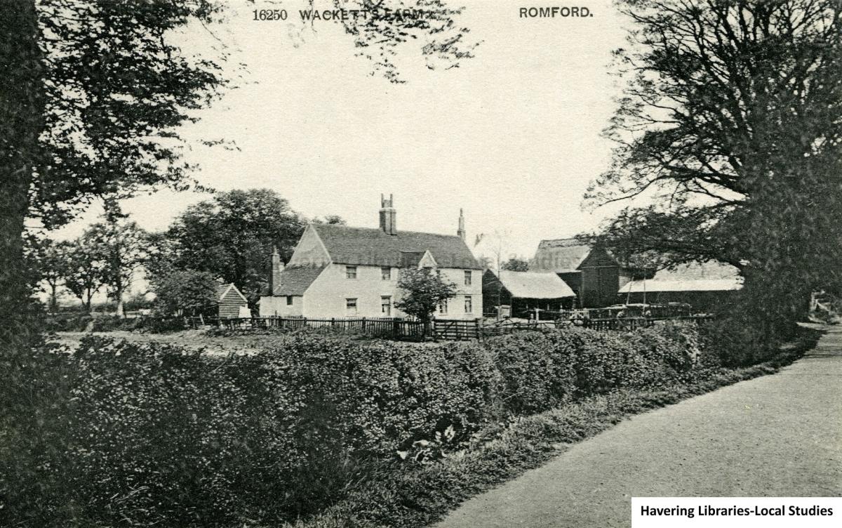
Wackett's Farm, Romford

Wackett's Farm in Romford, photographed around 1905, was also known as Lowlands Farm.
The farm was thought to have been demolished in 1955, according to Havering Libraries.
John Wackett of Bell House Farm in Rush Green was said to have worked the farmland at London Road.
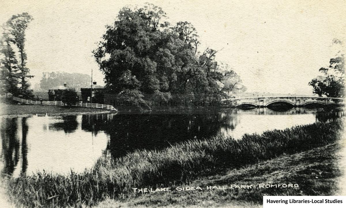
Pettits Farm to Black Bridge, Gidea Hall, Romford

An enchanting view of Pettits Farm to Black's Bridge in Gidea Hall can be seen here from around 1902.
The postcard shows a time shortly before the lake was included in what would be Romford's first public park, Raphael Park, according to Havering Libraries.
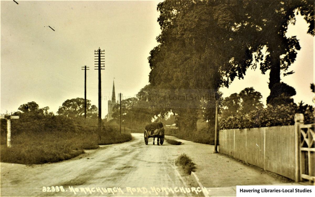
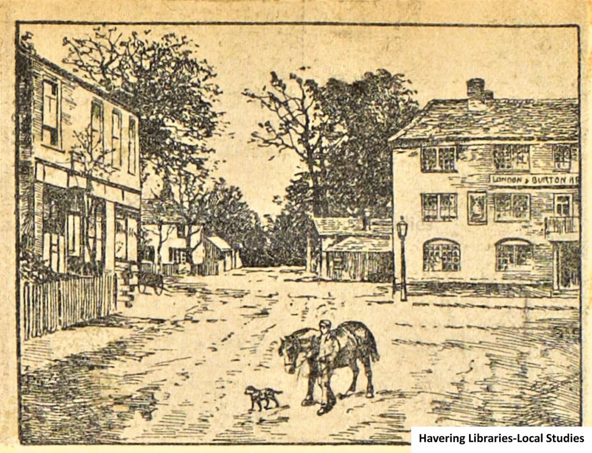
Doggett's Corner, Hornchurch

This is a postcard view of Doggett's Corner looking from Upminster Road toward St Andrew's Church.
The corner was named after James Doggett, buried in Hornchurch on June 1 in 1779.
Mr Doggett leased nearby "Durifalls Farm" for 21 years, according to Havering Libraries.
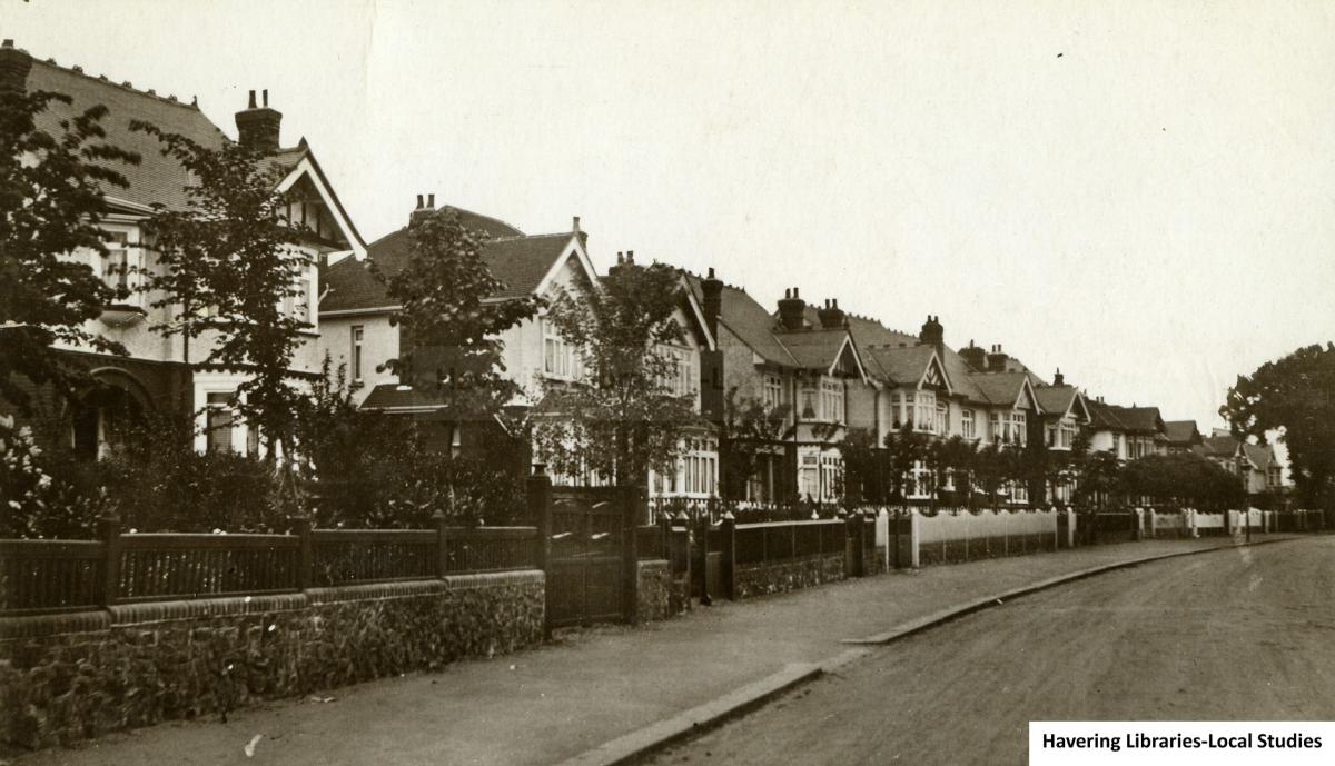
Hall Lane Upminster, circa 1906 & 1913


In 1906 plans were revealed to lay out around 700 acres of Upminster Hall Estate for building and in November that year work began to build Upminster Garden Suburb, according to Havering Libraries.
The 1913 photograph captures the built houses in that area, neatly sat next to each other with delicate trees scattered between.


Comments: Our rules
We want our comments to be a lively and valuable part of our community - a place where readers can debate and engage with the most important local issues. The ability to comment on our stories is a privilege, not a right, however, and that privilege may be withdrawn if it is abused or misused.
Please report any comments that break our rules.
Read the rules here